1/24


Marine Ways
1K+다운로드
13MB크기
1.81(11-06-2025)최신 버전
세부 정보리뷰버전정보
1/24
Marine Ways의 설명
면책 조항:
마린 웨이즈는 어떠한 정부 기관도 대표하지 않으며, 어떠한 정부 서비스도 제공하거나 촉진하지 않습니다.
마린 웨이즈는 미국 해양대기청(NOAA)과 제휴 관계가 없으며, NOAA를 대표하지 않습니다.
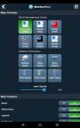
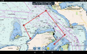
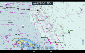
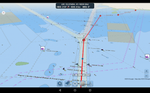
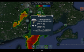
항로 계획 도구
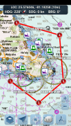
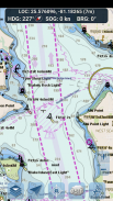
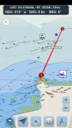
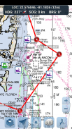
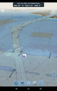
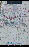
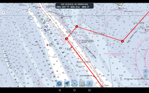
- 항로 작성. 지도를 1초 동안 탭하여 경유지를 작성하세요. 항로를 작성하려면 지도의 다른 영역을 계속 탭하여 탭하세요. 경유지를 추가, 조정 또는 삭제할 때 각 구간의 거리와 방위가 편리하게 계산되어 표시됩니다.
- 이동 모드. 이동 시 현재 위치를 지도 중앙에 자동으로 표시합니다. 이동 모드를 사용하면 작성된 항로를 얼마나 정확하게 따라가고 있는지 실시간으로 확인할 수 있습니다!
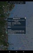
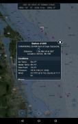
- 항로 구간 요약. 시작 및 종료 좌표, 거리, 방위를 포함하여 작성한 각 구간의 자세한 정보를 편리하게 확인할 수 있습니다.
앱을 즐겨보세요! Marine Ways는 http://www.marineways.com에서도 이용 가능합니다.
Marine Ways - 버전 1.81
(11-06-2025)뭐가 새롭나Clarify terms of subscription plan.Ads will be removed and the app will continue to operate when internet connection is not available when the user subscribes to our $1.99/month monthly subscription plan. The subscription plan can be cancelled at any time via the Google Play Store app, under subscriptions.
Marine Ways - APK 정보
APK 버전: 1.81패키지: com.marineways.android이름: Marine Ways크기: 13 MB다운로드: 102버전 : 1.81출시 날짜: 2025-06-11 11:07:39최소 스크린: SMALL지원되는 CPU: x86, x86-64, armeabi-v7a, arm64-v8a
패키지 ID: com.marineways.androidSHA1 서명: 5D:D6:E6:3D:20:FF:C0:E4:0B:B2:AB:B2:F6:42:DB:57:5C:7A:A4:35개발자 (CN): ArpeggioSoft LLC단체 (O): 로컬 (L): 나라 (C): 주/시 (ST): 패키지 ID: com.marineways.androidSHA1 서명: 5D:D6:E6:3D:20:FF:C0:E4:0B:B2:AB:B2:F6:42:DB:57:5C:7A:A4:35개발자 (CN): ArpeggioSoft LLC단체 (O): 로컬 (L): 나라 (C): 주/시 (ST):
Marine Ways의 최신 버전
1.81
11/6/2025102 다운로드13 MB 크기
다른 버전들
1.79
11/6/2025102 다운로드13 MB 크기
1.77
12/5/2025102 다운로드15 MB 크기
1.75
2/4/2025102 다운로드15 MB 크기
1.74
20/3/2025102 다운로드10 MB 크기
1.61
4/2/2025102 다운로드10 MB 크기
1.55
24/1/2025102 다운로드9.5 MB 크기
1.43
21/1/2025102 다운로드6 MB 크기
1.28
14/3/2023102 다운로드3.5 MB 크기
1.1
10/7/2018102 다운로드3.5 MB 크기


동일 카테고리의 앱


좋아할 만한 것...

English


